What is the relationship between poverty and natural resources?
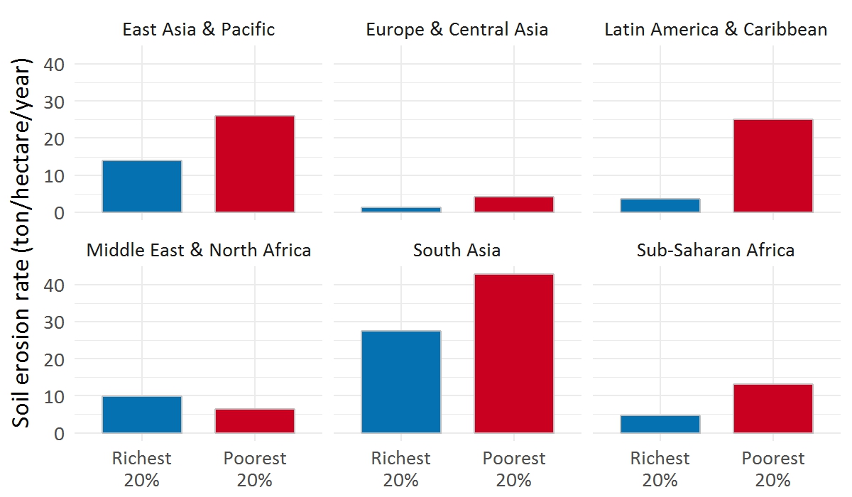
Who bears the burden of environmental degradation?
To answer these questions, our team curated the best publicly available global datasets, and created a sub-national database of socio-economic and environmental statistics.
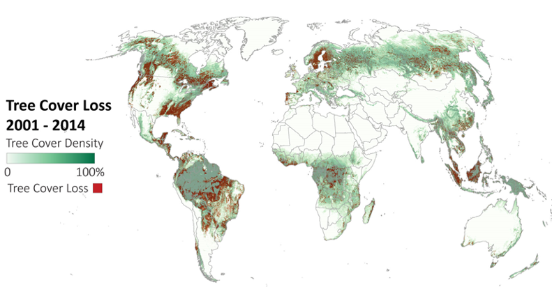
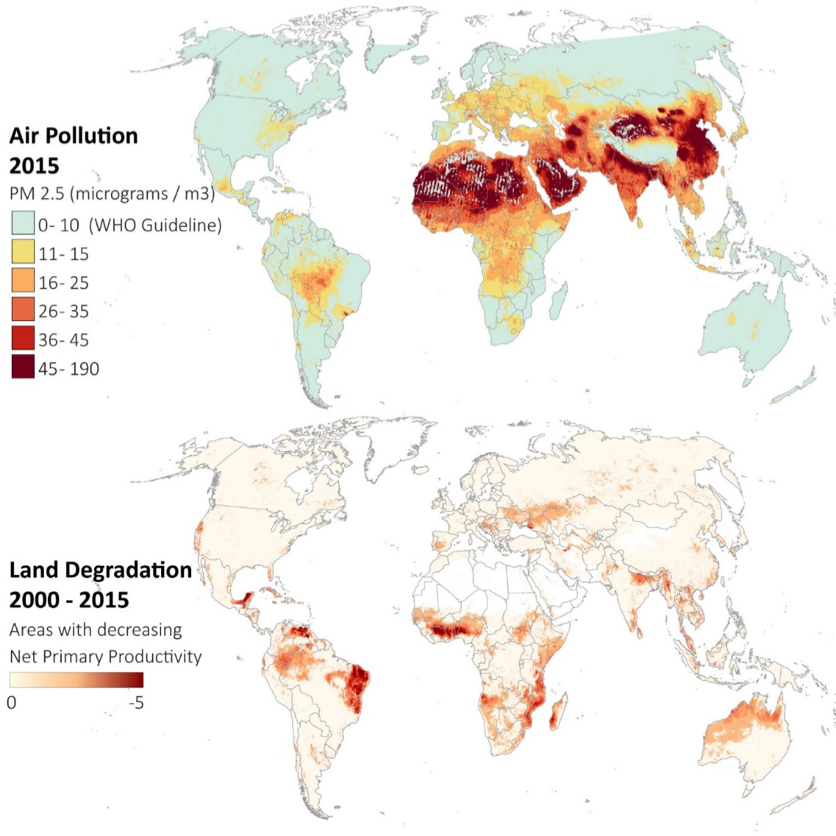
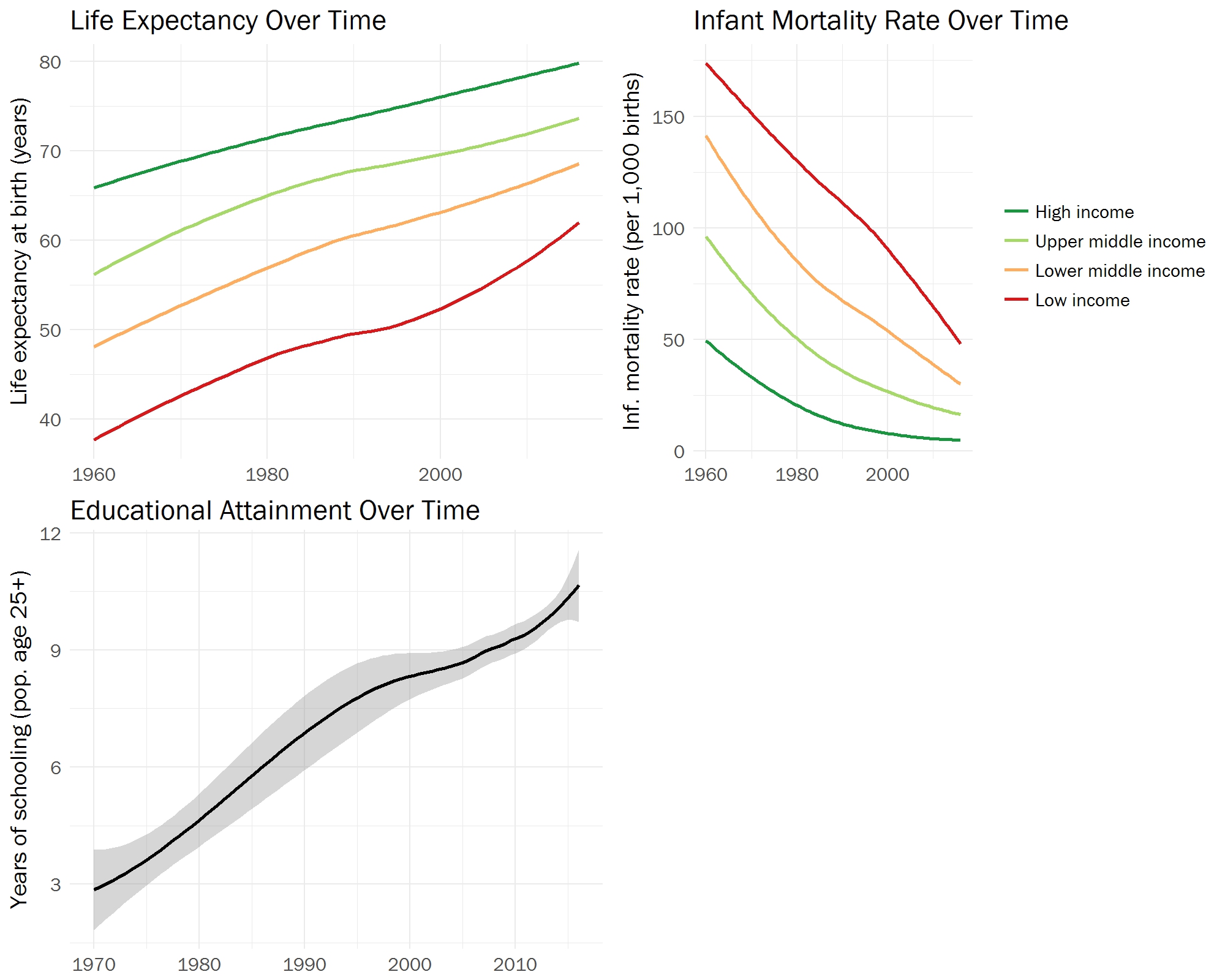
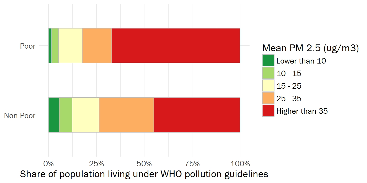

Sample Work
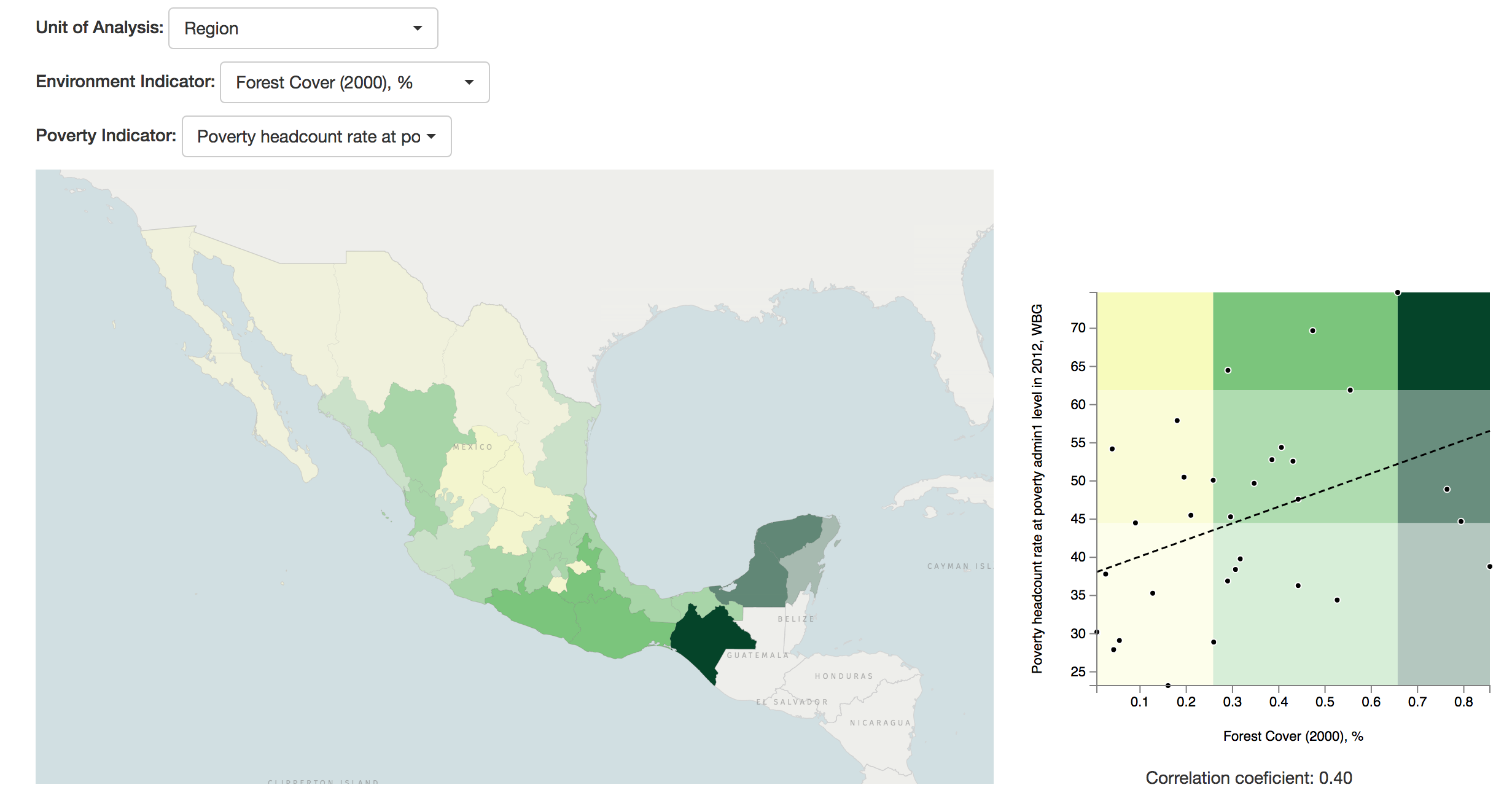
- I built an interactive tool to visualize bivariate correlations in our dataset. After seeing the website crash multiple times when reading the global dataset, I set up an API to load country data on demand.
- I helped extract statistics from a number of gridded datasets, using the arcpy python module from ArcGIS.
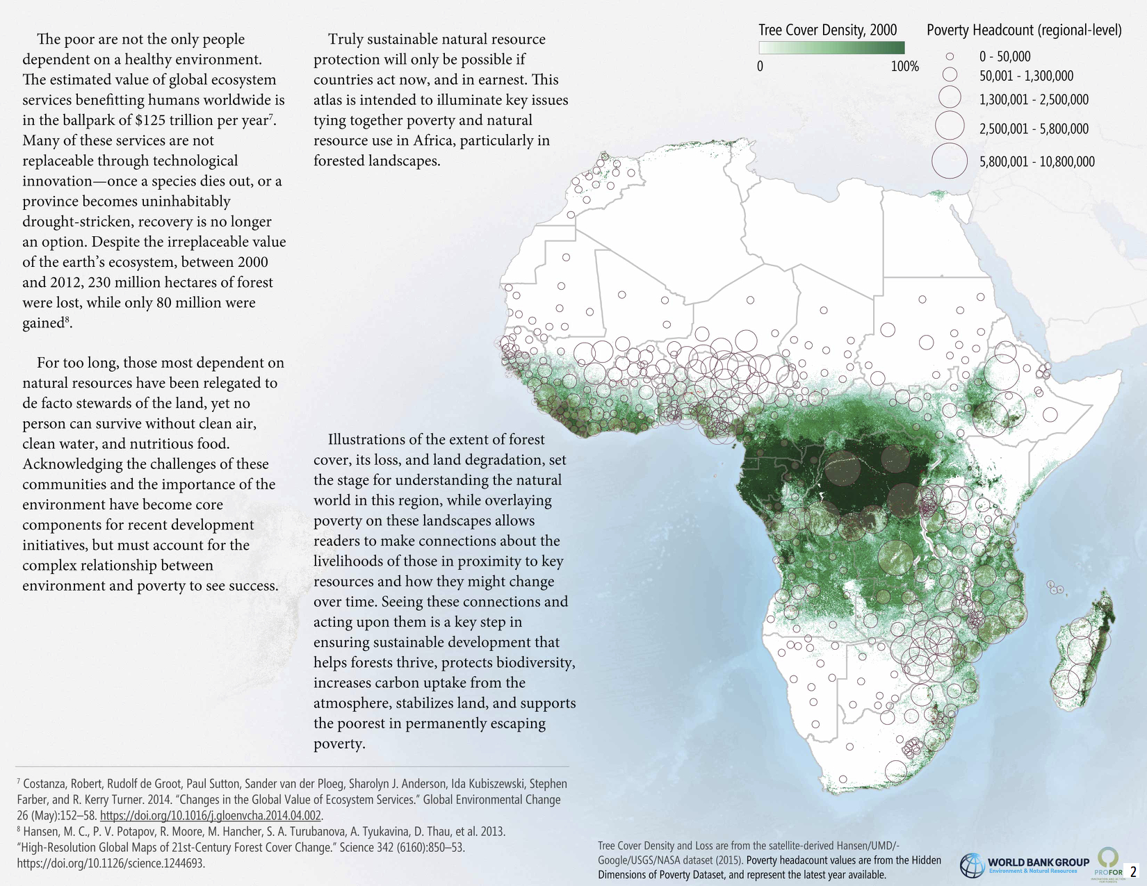
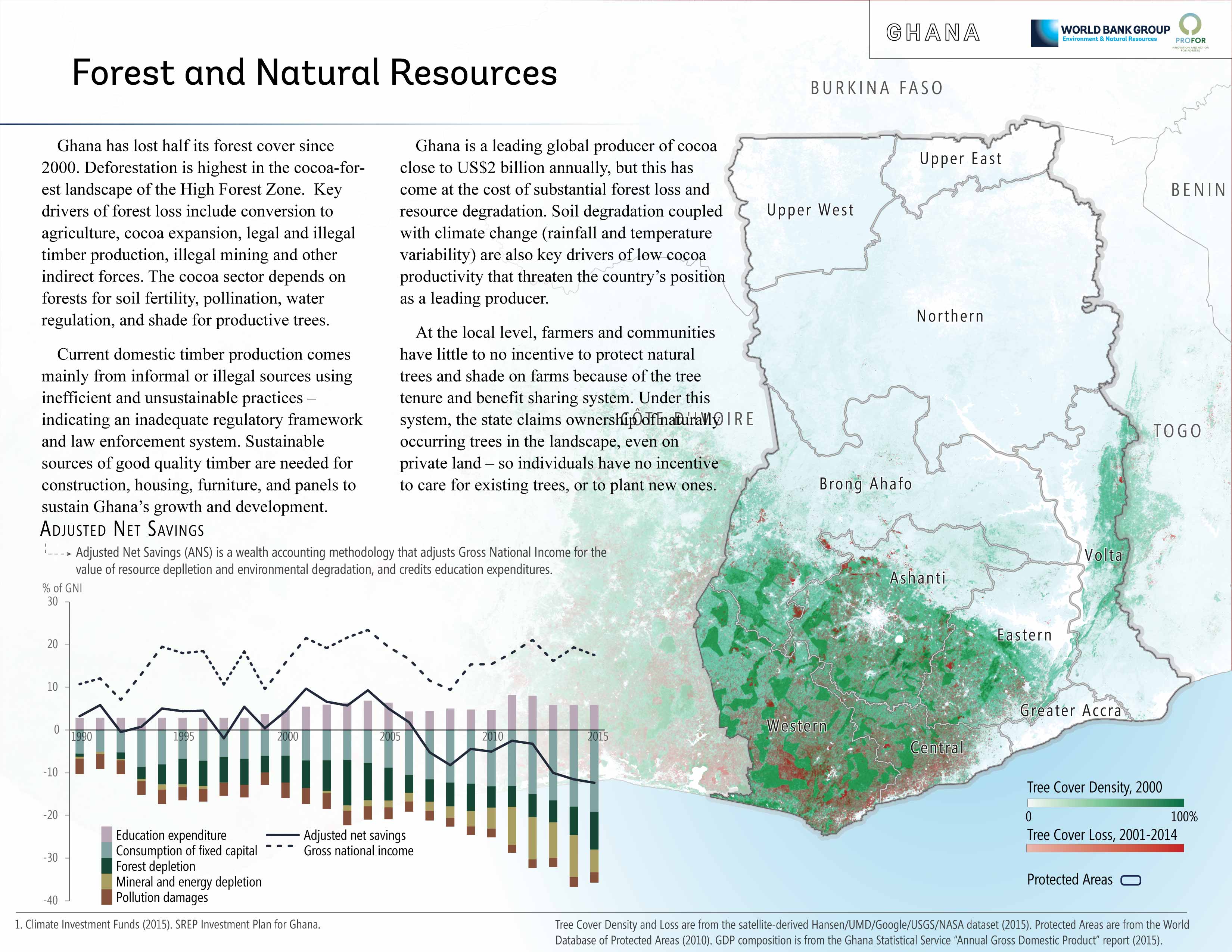
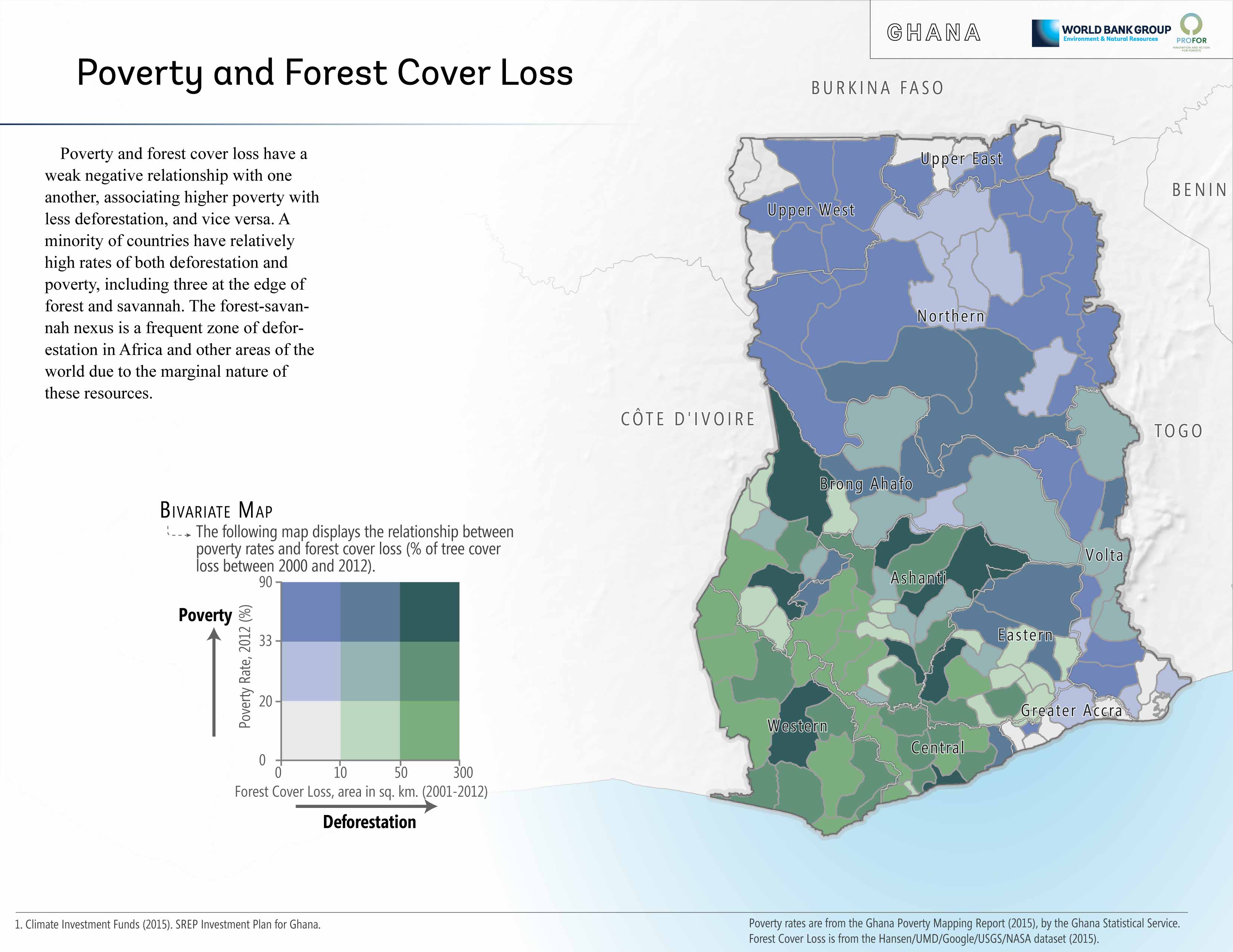
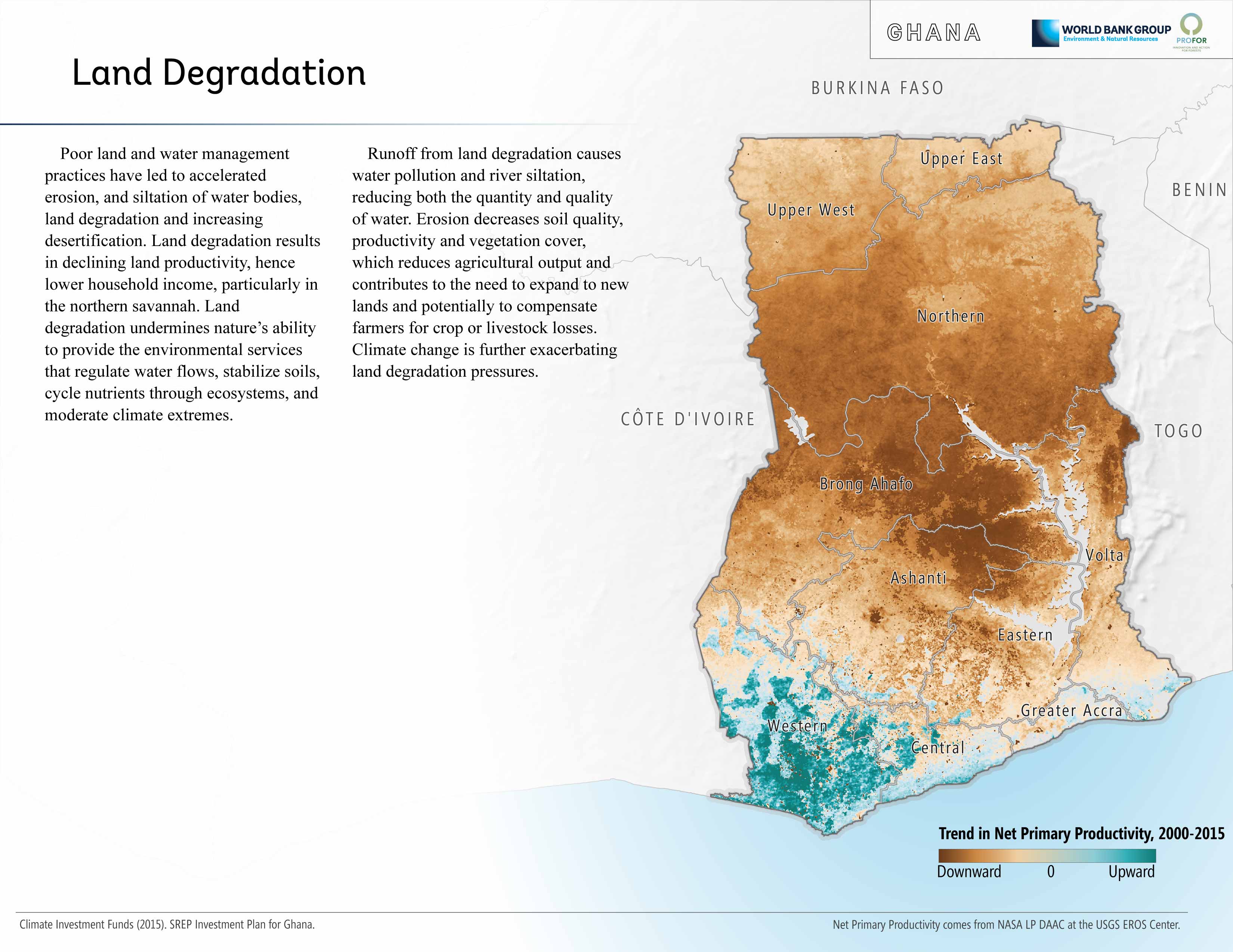
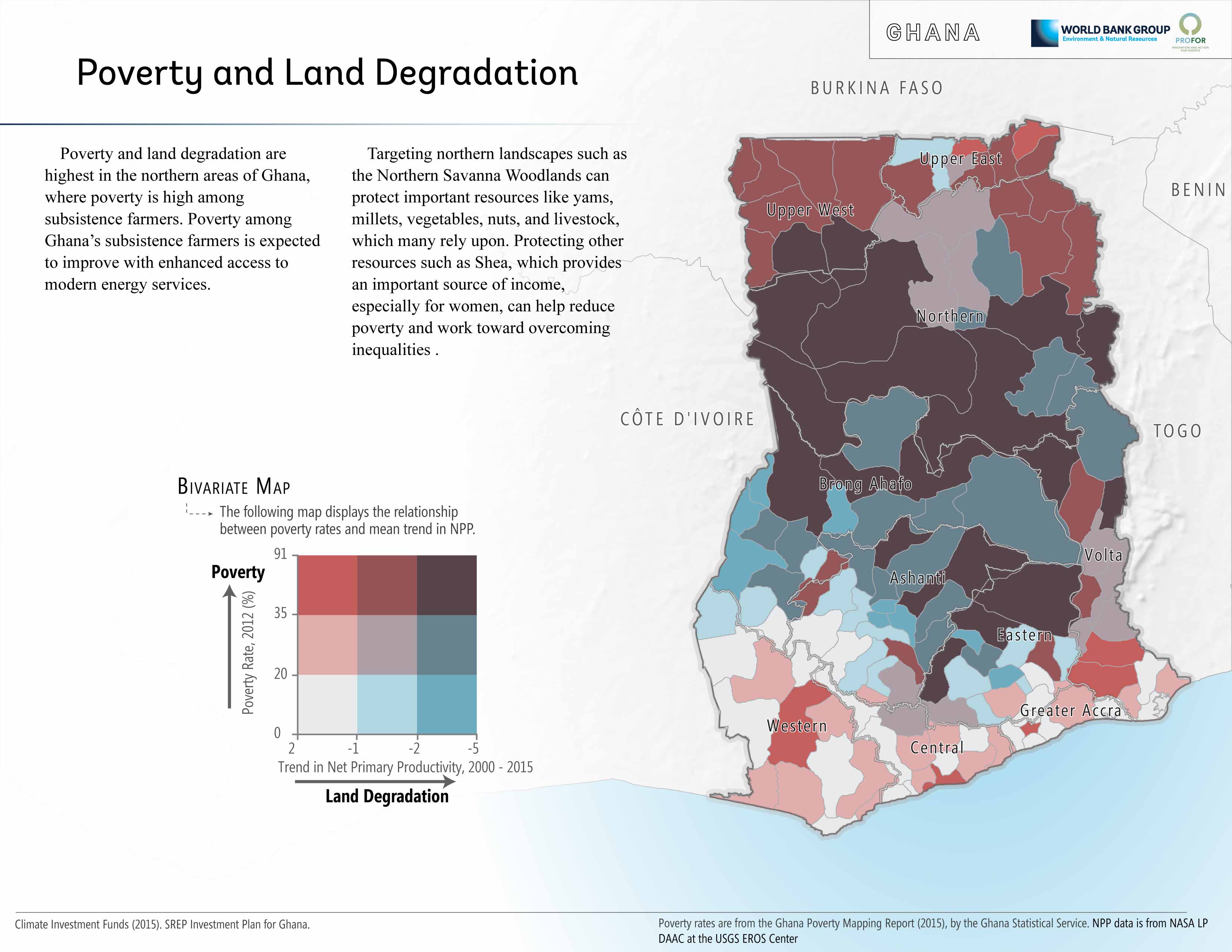
- I led the production of the Africa Forest Poverty Atlas, using mapnik and D3.js to automate the production maps and charts for 20 countries, refining the final layout in Adobe Illustrator.


The Hidden Dimensions of Poverty Database is now publicly available here.